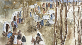
Farmers, fishermen, business owners, park managers and government officials from Kentucky counties along the Mississippi River met Thursday at Columbus-Belmont State Park for a National Geographic workshop on geotourism, which focuses on the distinctive geographical character of a place.
The Mississippi River Connections Collaborative, whose goal is to develop the Mississippi River Corridor, contacted National Geographic to create an interactive map of the region.
Simon Jones of National Geographic’s geotourism program says the program has existed for around a decade and has created similar interactive maps for a number of places like Greater Yellowstone and the Bahamas.
“This program is not about us coming in and telling the story of your place…. We provide the platform, but it’s about you telling the story in your own words and in your own voices about what you think is unique and authentic about your place. And then us providing the platform to get that story out to potential visitors,” Jones said.
Terry Eastin is the executive director of the Big River Strategic Initiative, a member of the Mississippi River Connections Collaborative along with organizations like the National Park Service, U.S. Fish and Wildlife Service, and the Delta Regional Authority. Eastin says her organization is focused on bolstering global tourism in the Mississippi River Delta in a way that preserves the region’s character and heritage.
“So it’s not about creating a tourism industry where the whole place gets destroyed and rebuilt as condominiums. It’s about encouraging new businesses to come in with similar interests to what’s already in the local area,” Eastin said.
Jones says tourism is a $1.5 trillion industry that employs eight million people in the United States. In the Delta, Eastin says tourism brings in 15 percent of total revenue, or about $15 billion a year, and employs 33 percent of the Delta’s workforce, while manufacturing brings in 70 percent of revenue and employs 35 percent of the workforce. She says developing tourism infrastructure in the region will help small communities tap into greater economic potential.
Brian Harper is a third generation owner of Harper’s Country Hams in Clinton. He says NatGeo interviewed his grandparents about their ham business in 1960 and he is excited to embrace the new tourism project.
“I definitely think it has the potential to bring a lot of people through this area once they know about what events that we have and what attractions that we have that they probably would never know about otherwise,” Harper said.
People who live around the Mississippi River can nominate a business, landmark, artisan or other entities that capture a sense of place at http://mississippiriver.natgeotourism.com. Nominations require visuals, such as pictures and videos, a description, a location, and contact information. Jones encourages nominations be filed by April as the interactive map will publicly launch in June. The map already includes 900 nominations, including several in Kentucky.


