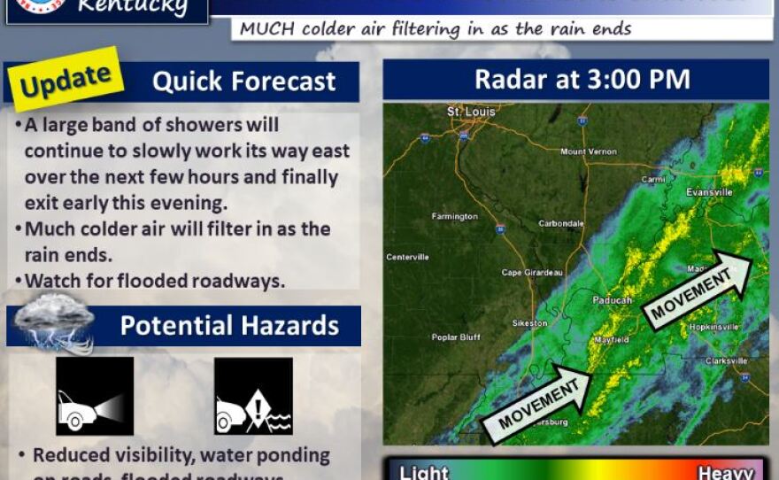
The National Weather Service in Paducah issued a flood watch Thursday for west Kentucky and southern Illinois as heavy rain continues to move through the area.
Meteorologist Ashley Ravenscrast said the NWS is warning drivers to be wary of flooded roadways. "Do not drive through it. You definitely want to turn around and seek another route. If you can’t see the road then it’s not safe to drive over it. Because you never know if the road has been washed out or you know, what you’re going to be driving into,” she said.
The National Weather Service said flash floods are still possible as well as isolated severe thunderstorms.
A drastic change to very cold arctic air will take place later Thursday afternoon. Wind chill readings by late night will be in the single digits and teens.
Wednesday: The National Weather Service in Paducah issued a flood watch Wednesday for west Kentucky and southern Illinois as heavy rain moves through the area.
Flood warnings are also issued in areas of counties that border the Ohio River and Mississippi River.
The National Weather Service said flash floods are possible as well as isolated severe thunderstorms throughout the evening and overnight.
The possibility for a brief spin-up of a tornado cannot be ruled out. The flood watch continues throughout Thursday.
This story has been updated.